42c. Argentina: Maritime museum of Ushuaia
The maritime museum of Ushuaia boasted a very extensive collection of ship models and naval attributes.
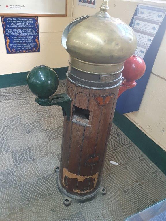
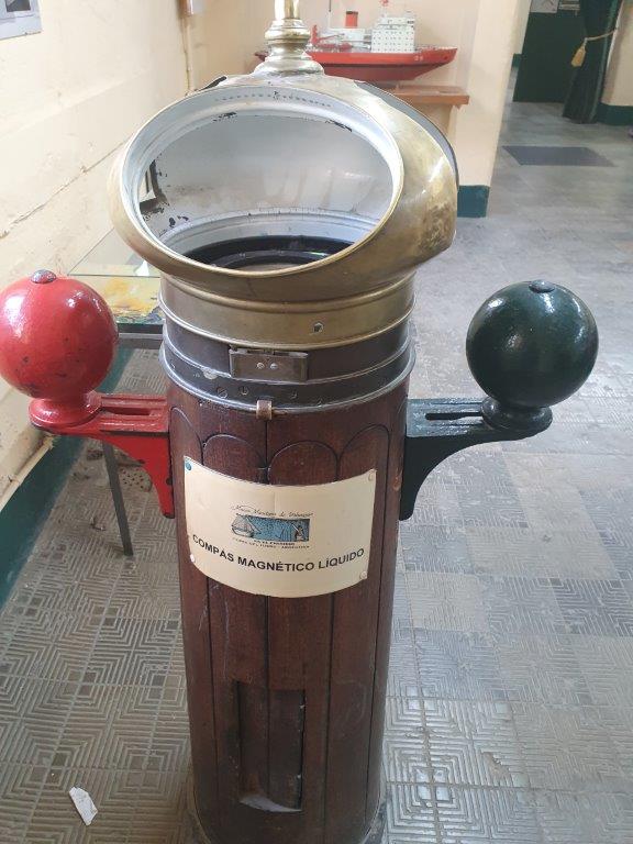
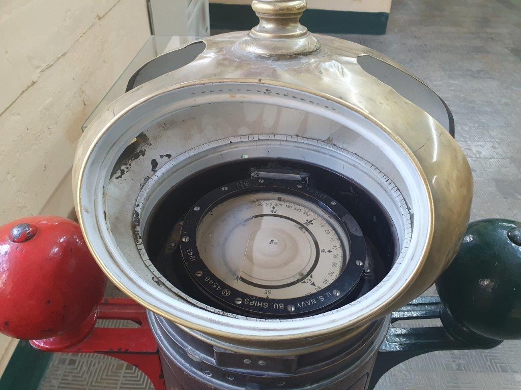
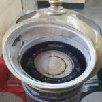
Why would the compass need adjustment, isn’t always supposed to point North? The reason is that as a critical piece of navigational equipment the accuracy of a ship’s compass can literally mean the difference between life and death for a ship and her crew. The compass’ accuracy must be maintained at the highest possible precision while at sea.
Like any magnetic device, compasses are affected by nearby ferrous materials, as well as by strong local electromagnetic forces. Compasses used for wilderness land navigation should not be used in proximity to ferrous metal objects or electromagnetic fields (car electrical systems, automobile engines, steel pitons, etc.) as that can affect their accuracy. Compasses are particularly difficult to use accurately in or near trucks, cars or other mechanized vehicles even when corrected for deviation by the use of built-in magnets or other devices. Large amounts of ferrous metal combined with the on-and-off electrical fields caused by the vehicle’s ignition and charging systems generally result in significant compass errors.
At sea, a ship’s compass must also be corrected for errors, called deviation, caused by iron and steel in its structure and equipment. The ship is swung, that is rotated about a fixed point while its heading is noted by alignment with fixed points on the shore. A compass deviation card is prepared so that the navigator can convert between compass and magnetic headings. The compass can be corrected in three ways. First the lubber line can be adjusted so that it is aligned with the direction in which the ship travels, then the effects of permanent magnets can be corrected for by small magnets fitted within the case of the compass.
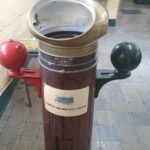
The effect of ferromagnetic materials in the compass’s environment can be corrected by two iron balls mounted on either side of the compass binnacle in concert with permanent magnets and a Flinders bar. The coefficient 


The ship models are all from the time of the great discoveries and explorations (mainly 16th and 17th centuries). Wooden sail ships. Chronologically this starts with the:
Trinidad 1520
Trinidad was the flagship (capitana) of Ferdinand Magellan’s 1519–22 voyage of circumnavigation. Unlike the Victoria, which successfully returned to Spain after sailing across the Indian Ocean under the command of Juan Sebastián Elcano, Trinidad attempted yet failed to sail east across the Pacific to New Spain.
Trinidad was a nao (carrack) of 100 or 110 tonels with square sails on the fore and main masts and a lateen mizzen. Its original crew was 61.
After Magellan’s death and the burning of the Concepción, Victoria and Trinidad (the San Antonio and the Santiago being lost earlier) reached Tidore on 8 November 1521. In mid-December both ships attempted to depart loaded with cloves, but Trinidad almost immediately began to leak badly. Inspection showed that the problem was serious. It was agreed that Victoria would leave for Spain and Trinidad would remain for repairs.
On 6 April 1522, Trinidad left Tidore loaded with 50 tonels of cloves. Her commander was Gonzalo Gomez de Espinosa, Magellan’s alguacil (master-at-arms), a good soldier, but no sailor. After ten days Trinidad put in at one of the Marianas, where three men deserted, and then headed northeast. Espinosa was apparently trying to reach the Westerlies, but did not find them, probably because of the summer monsoon. He reached 42 or 43 degrees north in increasingly bad weather. Scurvy set in, ultimately killing 30 men and leaving only 20 to sail the ship. Five months after leaving, he turned back and two months later reached the Moluccas.
Capture by Portuguese forces
The previous May a fleet of seven Portuguese ships under António de Brito reached Tidore, seeking to arrest Magellan. Espinosa sent Brito a letter begging for supplies. Brito sent an armed party to capture Trinidad, but, instead of armed resistance, they found only a ship on the verge of sinking and a crew near death. Trinidad was sailed back to Ternate where her sails and rigging were removed. The ship was caught in a storm and smashed to pieces.
Crew after capture
Only four of the survivors got back to Europe. Juan Rodriguez escaped in a Portuguese ship. The remaining three – commander Espinosa, seaman and expedition diarist Ginés de Mafra, and Norwegian gunner Hans Vargue (or Bergen) – spent two years at hard labor before being shipped to Lisbon and more prison. Vargue died in the Portuguese prison. Espinosa is last heard of in 1543 as a Spanish inspector of ships.
De Mafra, the last to be released because of the many documents he possessed, in time did become a pilot — in part because of the experience he gained with Magellan’s expedition. In 1541 he was named pilot of the San Juan de Letrán under Ruy López de Villalobos; two years later, wrecked on a Philippine island, he wrote about the Magellan expedition while waiting on ship repairs. Here the Magellan expedition was remembered favorably by royalty, and ultimately he with 29 other men chose to remain in the Philippines rather than resume with the failing Villalobos expedition. De Mafra’s notes from his wait remained unpublished until found in 1920.
De Eendracht 1616
The Eendracht was an early 17th century Dutch wooden-hulled 700 tonne East Indiaman, launched in 1615 in the service of the Dutch East India Company (VOC). Its Dutch name means “concord”, “unity” or “union”, and was a common name given to Dutch ships of the period, from the motto of the Republic: Concordia res parvae crescunt (“Eendracht maakt macht” / “Unity makes strength”). The ship was captained by Dirk Hartog when he made the second recorded landfall by a European on Australian soil, in 1616.
First voyage to the East Indies
Departure from Holland
Upon its commissioning, the Eendracht entered the service of the Dutch East India Company (Vereenigde Oostindische Compagnie, or VOC).
For her maiden voyage on the open ocean, the Eendracht set sail on 23 January 1616 from the Dutch port of Texel in the company of several other VOC ships, on a trading venture bound for Batavia in the Dutch East Indies (the present-day Jakarta). Her captain was Dirk Hartog, a thirty-five-year-old former private merchant, who had sailed for the VOC before but was now again in the employ of the VOC.
Route to Indian Ocean
Sailing down the west Africa coastline, the Eendracht became separated from the others in a horrible storm and reached the Cape of Good Hope alone around August. She stayed there until 27 August when Hartog decided to set out unaccompanied across the Indian Ocean towards their destination.
Hartog’s course across the Indian Ocean was a much more southerly one than the route usually followed. It made use of the prevailing westerly winds at those latitudes known as the “Roaring Forties”, a route which had been pioneered a few years earlier by the Dutch navigator Hendrik Brouwer, who had noted it to be a faster way to reach Java. By this time, the VOC had not as yet instructed all its captains to take advantage of this route, which could reduce the overall traveling time from Europe by a good six months. The decision to do so was taken just a few months after Hartog departed Amsterdam. So Hartog took that decision himself. However, later the intention was to change heading northwards at a more westerly longitude than the Eendracht had done. Whether Hartog had intended to maintain such a southerly course for so long via this route, or was perhaps blown a little off course, is unclear.
Landfall in Australia
After approximately two months at sea, on 25 October Hartog and the Eendracht unexpectedly sighted land – “various islands, which were, however, found uninhabited”, at a latitude around 26° South. These islands and the nearby land were previously unknown to Europeans, and the Eendracht had become the second recorded European ship to visit the continent of Australia, having been preceded (albeit, on the opposite side of the continent) 10 years earlier by Willem Janszoon on the Duyfken sailing along, and landing on, the western shores of the Cape York Peninsula just months before Luís Vaz de Torres sailed through the straight that now bears his name without leaving records of seeing land on his south.
Hartog and crew made landfall on the island, now known as Dirk Hartog Island which lies off Shark Bay in Western Australia. This was the first recorded landing on the western coastline by a European. The island was uninhabited, and Hartog spent three days there, finding nothing of great interest or value to him or his company.
Before departing on 27 October, Hartog left behind a pewter dish affixed to a post set in a rock cleft (now called Cape Inscription), upon which he had inscribed the following brief account of his visit:
1616 On 25 October arrived the ship Eendracht, of Amsterdam: Supercargo Gilles Miebais of Liege, skipper Dirch Hatichs of Amsterdam. on 27 d[itt]o. she set sail again for Bantam. Deputy supercargo Jan Stins, upper steersman Pieter Doores of Bil. In the year 1616.
This object, now known as the Hartog Plate, measuring 36.5 cm (14.4 in) in diameter, is the oldest known written artifact from Australia’s European history. It lay unmolested in situ for a further eighty years, until it was re-discovered half-buried (the post had rotted away) by a Dutch expedition of three ships under the command of the Flemish captain Willem de Vlamingh in 1697. De Vlamingh had earlier explored Rottnest Island and the Swan River (later to be the site of the city of Perth), and had been making his way up the western coast of Australia. He replaced the Hartog dish with one of his own, onto which he copied Hartog’s original inscription and added an account of his own landing, installing it in the same spot nailed to a cypress-pine trunk taken from Rottnest. Hartog’s original dish returned with De Vlamingh later to Amsterdam, where it is displayed in the Rijksmuseum.
Charting the coast of Western Australia
 Caert van’t Landt van d’Eendracht (detail naming the Mauritius as ship used for the discovery of the Willems River) by Hessel Gerritsz, stating, Willems revier, besocht by ‘t volck van ‘t Schip Mauritius in Iulius A° 1618 (“Willem’s River, visited by the crew of the ship Mauritius in July 1618”). [This cropped image has been reoriented 90 degrees right from the original chart with north to top]
The Willems River discovery added to the boundary of Eendrachtsland in 1618, as shown by the prominence given to Eendrachtsland as the main name on the chart as the name for this South-land. It names the Mauritius as the ship used for the discovery of the Willems River. The text on this close-up cropped image says, Willems revier, besocht by ‘t volck van ‘t Schip Mauritius in Iulius A° 1618 (“Willem’s River, visited by the crew of the ship Mauritius in July 1618”).
Return voyage to the Netherlands

Second voyage to the East Indies
Shipwreck
The Beagle 1833
HMS Beagle was a Cherokee-class 10-gun brig-sloop of the Royal Navy, one of more than 100 ships of this class. The vessel, constructed at a cost of £7,803, was launched on 11 May 1820 from the Woolwich Dockyard on the River Thames. Later reports say the ship took part in celebrations of the coronation of King George IV of the United Kingdom, passing under the old London Bridge, and was the first rigged man-of-war afloat upriver of the bridge. There was no immediate need for Beagle, so she “lay in ordinary”, moored afloat but without masts or rigging. She was then adapted as a survey barque and took part in three survey expeditions.
|
HMS Beagle in the Straits of Magellan at Monte Sarmiento, reproduction of R. T. Pritchett’s frontispiece from the 1890 illustrated edition of The Voyage of the Beagle.
|
Beagle was immediately taken into dock at Devonport for extensive rebuilding and refitting. As she required a new deck, FitzRoy had the upper-deck raised considerably, by 8 inches (200 mm) aft and 12 inches (300 mm) forward. The Cherokee-class ships had the reputation of being “coffin” brigs, which handled badly and were prone to sinking. Apart from increasing headroom below, the raised deck made Beagle less liable to top-heaviness and possible capsize in heavy weather by reducing the volume of water that could collect on top of the upper deck, trapped aboard by the gunwales. Additional sheathing added to the hull added about seven tons to her burthen and perhaps fifteen to her displacement.
The ship was one of the first to be fitted with the lightning conductor invented by William Snow Harris. FitzRoy spared no expense in her fitting out, which included 22 chronometers, and five examples of the Sympiesometer, a kind of mercury-free barometer patented by Alexander Adie which was favoured by FitzRoy as giving the accurate readings required by the Admiralty. To reduce magnetic interference with the navigational instruments, FitzRoy proposed replacing the iron guns with brass guns, but the Admiralty turned this request down. (When the ship reached Rio de Janeiro in April 1832, he used his own funds for replacements: the ship now had a “six-pound boat-carronade” on a turntable on the forecastle, two brass six-pound guns before the main-mast, and aft of it another four brass guns; two of these were nine-pound, and the other two six-pound.)
FitzRoy had found a need for expert advice on geology during the first voyage, and had resolved that if on a similar expedition, he would “endeavour to carry out a person qualified to examine the land; while the officers, and myself, would attend to hydrography.” Command in that era could involve stress and loneliness, as shown by the suicide of Captain Stokes, and FitzRoy’s own uncle Viscount Castlereagh had committed suicide under stress of overwork. His attempts to get a friend to accompany him fell through, and he asked his friend and superior Captain Francis Beaufort to seek a gentleman naturalist as a self-financing passenger who would give him company during the voyage. A sequence of inquiries led to Charles Darwin, a young gentleman on his way to becoming a rural clergyman, joining the voyage. FitzRoy was influenced by the physiognomy of Lavater, and Darwin recounted in his autobiography that he was nearly “rejected, on account of the shape of my nose! He was an ardent disciple of Lavater, & was convinced that he could judge a man’s character by the outline of his features; & he doubted whether anyone with my nose could possess sufficient energy & determination for the voyage.”
Beagle was originally scheduled to leave on 24 October 1831, but because of delays in her preparations the departure was delayed until December. Setting forth on what was to become a ground-breaking scientific expedition, she departed from Devonport on 10 December. Due to bad weather her first stop was just a few miles ahead, at Barn Pool, on the west side of Plymouth Sound. Beagle left anchorage from Barn Pool on 27 December, passing the nearby town of Plymouth. After completing extensive surveys in South America she returned via New Zealand, Sydney, Hobart Town (6 February 1836), to Falmouth, Cornwall, England, on 2 October 1836.
Darwin had kept a diary of his experiences, and combined this with details from his scientific notes as the book titled Journal and Remarks, published in 1839 as the third volume of the official account of the expedition. This travelogue and scientific journal was widely popular, and was reprinted many times with various titles and a revised second edition, becoming known as The Voyage of the Beagle. Darwin 1989, pp. 2–3, 24.

