38. Greenland: Dutch 17th & 18th century whale hunters leaving geographic names on Greenlandic maps explained & a rough boat ride …
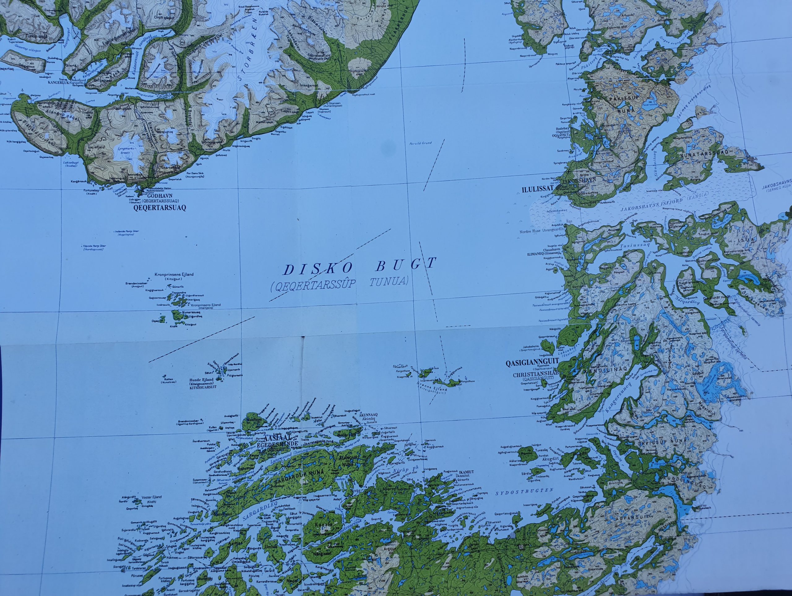
The Wandelgek arrived at the harbor of Qeqertarsuaq without any hope of leaving the Disko island, because the storm that had been blowing all morning had not diminished even for an inch. It didn’t blink. It seemed to say: You are not gonna leave this island for the next month and then winter will take over and you are gonna be stuck here until next Spring…
The captain of the ferry boat was still negotiating with his colleagues when suddenly he announced that he would leave and try the crossing of the Disko Bay towards the Aasiaat archipelago. I asked him what had changed his mind in relation to the situation earlier this morning. I mean. The wind was just as severe and cold and the waves looked just as menacing. Then he explained that 2 things did have changed. 1st: the wind direction had turned and it meant that waves would now come sideways instead of from the front. 2nd: A second boat had arrived and we would make the crossing together under the condition that both boats would keep eye contact. This way one boat could help the other in case of an emergency.
It was decided than. The Wandelgek could finally board the ferry and leave for Aasiaat.
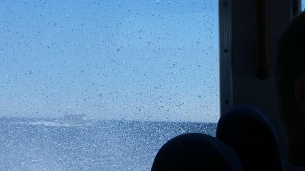
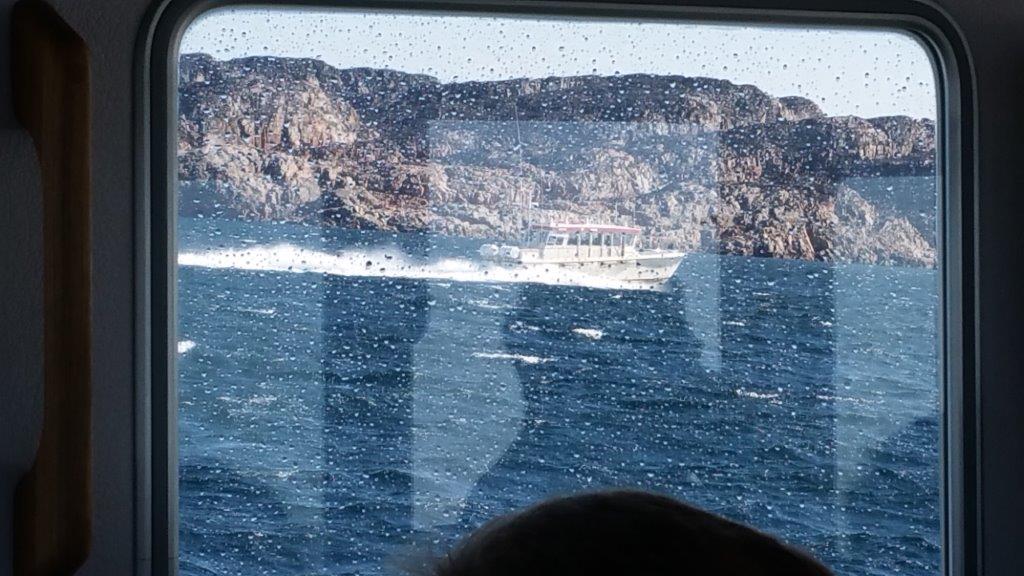
It would not be a boatride for daisies though. The waves played with the toy boats and tossed them left right up and down again like tennis players do with a ball, meanwhile the huge icebergs lay like mountains in the water not moved even an inch… or so it seemed.
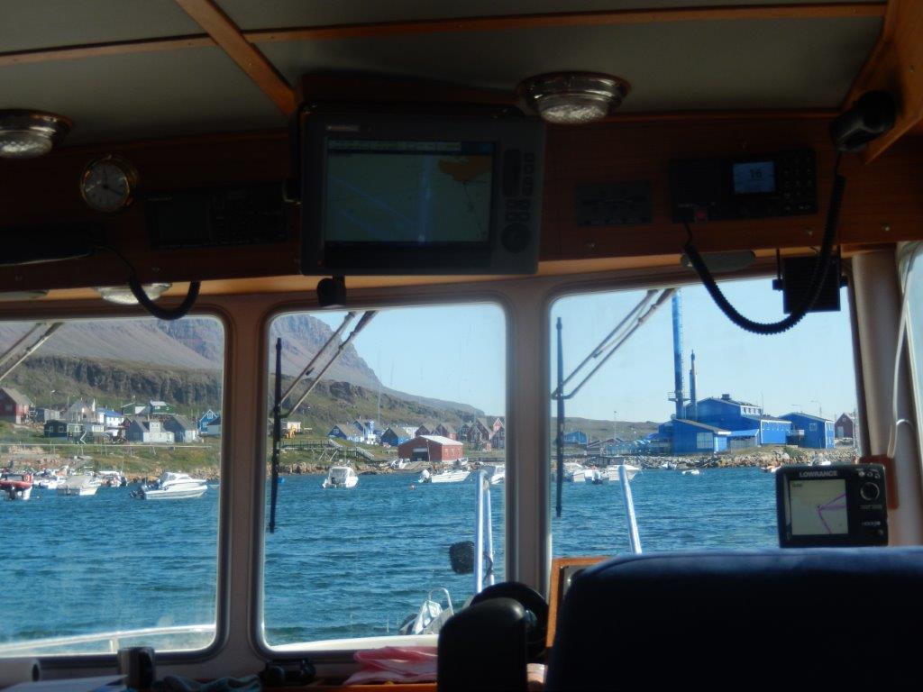
After leaving the harbor of Qeqertarsuaq/Godhavn, reaching open water, the full force of the waves was felt, pounding every few seconds against the side of the boat, lifting it upwards and then making it descend again into an abyss until the next wave came along. It felt like standing in an elevator that went haywire. The stomach and containing its content within, were tested to the extreme.
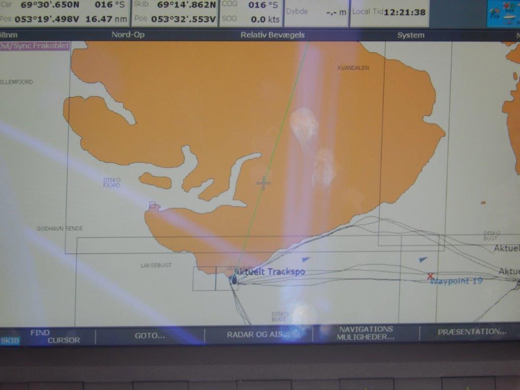
I checked the screen above the captains seat regularly. It showed whether we were still on course and whether we had reached the small groups of islands en route, where there was a bit of shelter from the full force of the storm…
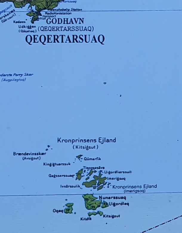
We passed through the center of 2 small groups of islands. 1st of those was Kronprinsens Ejland (Kitsigsut).
European Language on Greenlandic maps
This is actually a great opportunity to talk about one of The Wandelgek’s greatest hobbies: The evolution of language through history. 1st though I need to explain that he is fascinated by maps from a very young age. More about that can be found in this blogpost: Theme blog: A fondness for maps …
Introduction
The geographic maps of Greenland are full of Kalaalissut (Inuit Greenlandic) and Danish names, but there are also alot of foreign names like Norwegian, Dutch and French names to be found.
Why? How did those get there and why are they still there?
When I visited Greenland it struck me how many names I thought I could translate into dutch without effort. Iniitially I thought this was because of danish and dutch being both Germanic languages, but after a while I thought tgat too easy an explanation and I started doing some research.
After research I started thinking and rethinking and re-rethinking about this post for a long time. Where to fit it in with the rest of my Greenland posts? How deep did I want to dig. Did it have to be exclusively about foreign language geographic names in Greenland or was a more wider approach neccesary to explain these strange names on the maps. In the end I chose a broad view approach but combined with loads of examples of geographic names illustrated with maps (modern and historic) and a link to a very helpful source.
I hope that this post will help visitors of Greenland explain how certain names got on to Geographic maps and I’d encourage them to dig a bit further because language is an excellent entrance to get to know more about a countries hisyory and identity…
About language and geography and cultural differences
Anyone who ever read literature or travel books that included maps, specially when it included historic maps, must have noticed that language used to name geographic locations is often:
- defined by who is naming those locations and why;
- it is also defined by who is in power in or simply who 1st visited specific areas at the time when those maps are created;
- it is defined by what people in the time when the map was created knew about the world.
Let me explain this a bit more with some examples:
- In Greenland there has always been a mixture (not a meltingpot though) of Canadian Origin Inuit peoples and European Colonists (mainly but not exclusively from Denmark). Both groups have named geographic locations and both are seen on modern and on historic maps of the country. Both groups lived in Greenland but for quite different purposes and thus life styles and culture. This was reflected in the way they named similar locations. The Inuit were hunters and fishermen and they were in Greenland to live there and survive. This was reflected in the manner of choosing names for locations which mostly describe natural features that they could use to recognize their immediate surroundings and navigate them. This meant that in Kalaallissut, names like Iceberg (iluliaq) or plural Icebergs (ilulisat) were given to specific locations. Other typical names are Mountain (qaqqaq) The colonists however were there to find minerals or to hunt whales or to explore the country in the service of foreign powers/kings or in the service of local representatives of those foreign powers. Their name giving of locations was thus more influenced by whom they served. Names like Egedesminde, Kron Prinsens Ejland or Jacobshavn were common among those but also names that related to them hunting, like Hunde Ejland or them being far from home like Kap Farvel.
- When I visited the area of the Eqip Sermia glacier way up north in the Disko Bay, I noticed that there were several French names on the map of that area. How come they were not Danish or Inuit? Well. Greenland is huge but very scarsely populated and it always has been.like that. This meant several areas of the country were never visited or never mapped. When a French arctic explorer like Paul Emile Victor landed at the Eqip Sermia glacier to get easy access to the inland ice sheet which he wanted to explore, there were no locals there that had named the mountains, rivers and lakes. He needed to bame those because this is how humans communicate about their environment. He was building a trail towards the ice sheet and to be sure that everyone contributing in the building process would know exactly where to move forward, he needed names for geographic entities. He was French and so those names were in French language, like e.g.: Lac des Canards, Port Victor, Laq Superieur, Lac Inferieur, lac Moyen, Col de Perdrix, Crêtes de lièvres Blancs and maybe even Eqi (not sure of that though). If you follow only the French names on the map, you get from the coast to the Inland Ice sheet.
- A 3rd contributing factor to the giving of names on maps is of course what people knew about yhe world when they did. This is why on old historic maps we see sea monsters, dragons, etcetera on the edges of the maps and people walking upside down in Australia and dangerous looking, but non existent animals in the center of then unknown Africa.
Dutch names on Greenlandic maps
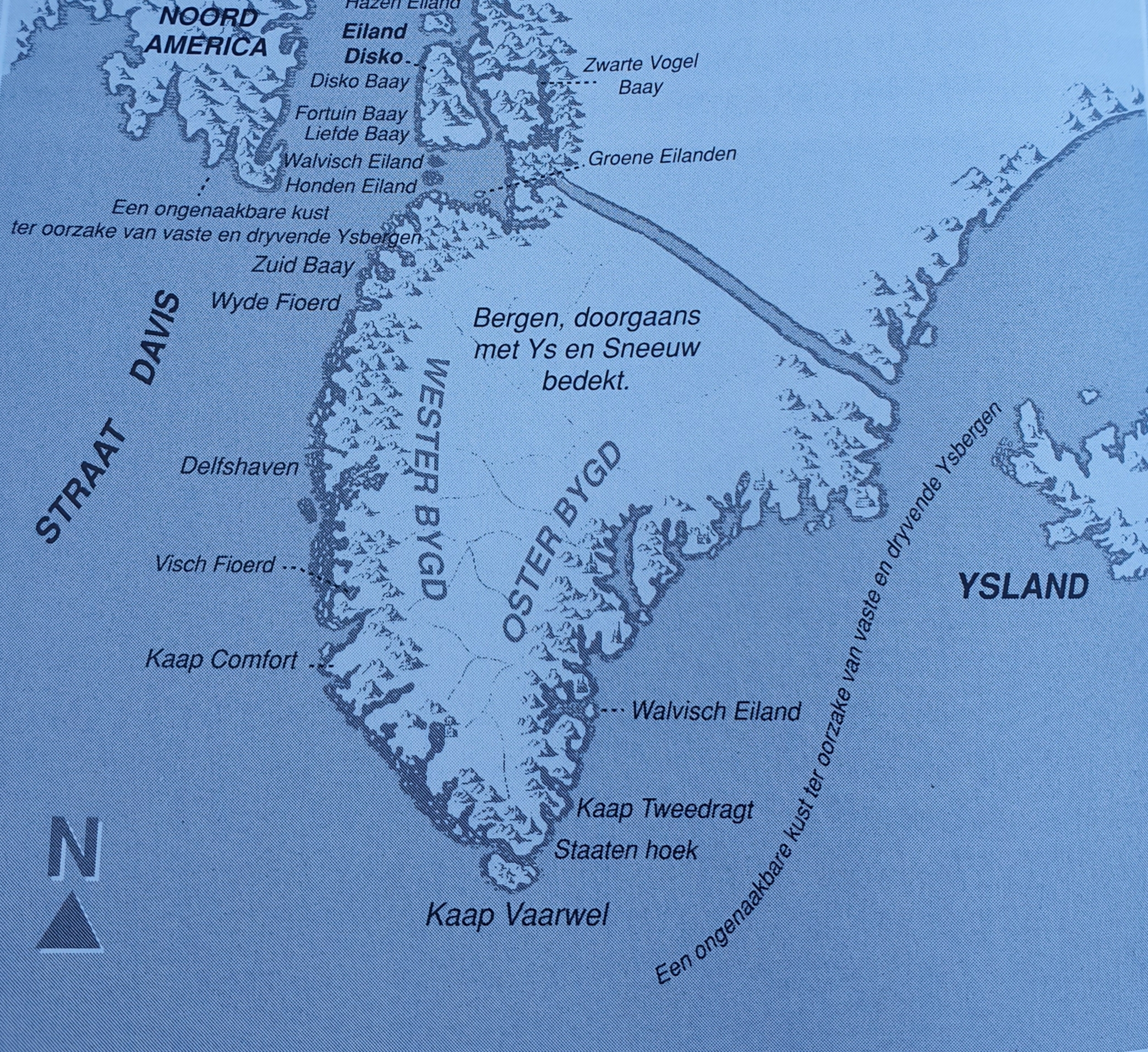
And that brings us back to the maps of Greenland, e.g. this beautiful historic map which includes many names that were introduced by Dutch whale hunters:
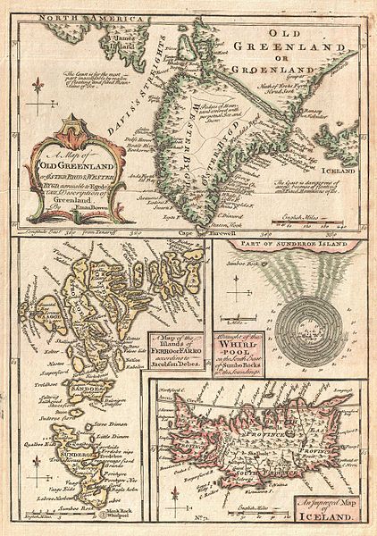
A singularly fascinating 1747 map of Greenland, Iceland and the Faroe Islands by E. Bowen. Essentially four maps on one sheet, this map of the North Atlantic islands is festooned with speculation and curiosities. The uppermost map is based on reports by the priest Hans Egede and shows the southern portions of Greenland as well as parts of Iceland and James Island. When this map was drawn the coasts of Greenland were fairly well mapped out by Icelandic and Scandinavian whalers, but the interior was largely unknown. There was some speculation in the early 17th and 18th centuries that a water passage existed through Greenland providing easy access to Iceland from the Davis Straights. Our map notes the passage but also comments that it is now impassable due to ice. Bowen also notes that the seas on either side of the Island are treacherous due to mountains of Ice. The lower left map depicts the Faroe Islands. Today these stunning green islands are considered one of the most beautiful and unspoiled places on earth. Our map depicts the Faroe Islands according a map contained in a 17th century book on the islands written by Jacobson Debes. The Faroe Islands have been historically treacherous for mariners due to the unpredictable currents and tides surrounding them. One of the most curious and legendary results of these currents is the great maelstrom that once roared at the southern tip of Sunderoe (today Suouroy Island) – depicted on our map at the right center. This mighty whirlpool swirled around a sheer pinnacle of rock called Monek, which was said to resemble a monk from one side and a sailing ship from the other. Reports say that the whirlpool was over a mile in diameter. Soundings show that the waters surrounding the whirlpool had a depth of some 80 to 90 fathoms, but that the waters nearer the rock, at the center of the maelstrom, were but 7 to 10 fathoms deep. Sadly this startling natural phenomenon is no more. In 1884 much of Monek Rock crumbled into the sea, creating a dangerous underwater reef and displacing the unique convergence that created the maelstrom. In the lower right hand corner of our chart is a map of Iceland. Iceland had been fairly well mapped since the late 16th century. This map, updated from earlier maps, shows the royal residence and four primary provinces. Drawn my Emmanuel Bowen for issue in his 1747 edition of A Complete System of Geography…
On the map above you can spot names in ancient Dutch like (Not all names reappear on modern maps, sometimes because the location is deemed to small to name, but they are still in use for those locations e.g. because locals still use them, but sometimes the name dissapeared completely like e.g: Staaten Hoek)):
- Honden Eiland (On modern map: Hunde Ejland/ Modern Dutch: Hondeneiland/English: Dog(Hound) island)
- Straat Davis (On modern map: Strait Davis)/Modern Dutch: Straat Davis or Straat van Davis)/English: Strait Davis)
- Zwarte vogel baai
- Walvisch Eiland (twice) (On modern map: ???/Modern Dutch: Walviseiland/English: Whale Island)
- Hazen Eiland (On modern map: Hareoen/Modern Dutch: Hazeneiland/English: Hare Island)
- Groene eilanden (On modern map: Grønne Ejland/Modern Dutch: Groene eilanden/English: Green Islands)
- Fortuin Baay (On modern map: Fortunbay/Modern Dutch: Fortuinbaai/English: Fortune Bay)
- Disko Baay (On modern map: Disko Fjord/Modern Dutch: Diskobaai/English: Disco Bay)
- Eiland Disko (On modern map: Disko/Modern Dutch: Disko-eiland/English: Disco Island)
- Liefde Baay (On modern map: ???/Modern Dutch: Liefdebaai/English: Love Bay)
- Zuid Baay (On modern map: ???/Modern Dutch: Zuidbaai/English: South Bay)
- Wyde Fioerd (On modern map: ???/Modern Dutch: Wijde fjord/English: Wide fjord)
- Delfshaven (On modern map: ???/Modern Dutch: Delfshaven/English: Harbor of Delft)
- Visch Fioerd (On modern map: ???/Modern Dutch: Visfjord/English: Fish Fjord)
- Kaap Comfort (On modern map: ???/Modern Dutch: Kaap Comfort/English: Cape Comfort)
- Kaap Vaarwel (On modern map: Kap Farvel/Modern Dutch: Kaap Vaarwel/Danish derived from Dutch: Kap Farvel/English: Cape Farewell)
- Staaten hoek (On modern map: ???/Modern Dutch: Staten Generaal (Parlement) Hoek/English: Parlements Corner)
- Kaap Tweedragt (On modern map: Kap Farvel/Modern Dutch: Kaap Tweedracht/English: Cape … )
- Walvisch Eiland (2nd occurrence)
- Wester Bygt (Modern Dutch: Westerbocht)/English: West curve)
- Oster Bygt (Modern Dutch: Oosterbocht/English: East curve)
Not on the historic map, but still found on modern Greenlandic maps are e.g: Hollænderbugt and Rodebay.
The word Disko (used for Disko Island and Disko Bay) is a Dutch name that was brought to Greenland from Svalbard (Dutch : Spitsbergen), where the Dutch whale hunters were until the amount of whales dimished. In Spitsbergen/Svalbard the name Dusko and later Disko was used). When yhe Dutch whale hunters moved their activity to the Strait of Davies and to Greenland, they brought these names with them and simply re-used them.
Another typical Dutch word often used by Dutch whale hunters (and other Dutch explorers too) was the word Haven. Haven in Dutch means harbour in English. This specific word has been adopted into Danish language where it became havn. Thus names like Jakobshavn and Godhavn have Dutch roots.
More words derived from Dutch: Sukkertoppen (from suikertop), Sugarloaf (from suikerbrood), Hab (instead of Havn).
Another Dutch word that got adopted into Danish was Eiland (English Island), which became Ejland in Danish. It is still used for: Arve Prinsens Ejland, Kronprinsens Ejland, Grønne Ejland and Hunde Ejland.
Dutch Groene (Green) eilanden became Grønne Ejland in Danish.
Then there is the name of Rodebay ( Dutch: Rodebaai) which is derived from Dutch. I’s modern Kalaallisut name is Oqaatsut which means Cormorant in English (and Aalscholver in Dutch). The settlement first operated as Rodebay, a trading post for 18th-century Dutch whalers.
There are much more names derived from Dutch language that can still be found in Greenland today, as there are of Danish, Norwegian and French origin.
These sources gives an excellent, although maybe not complete overview of European names that were ones in use or still are being used in Greenland today: Language Contact across the North Atlantic
Language Contact in the Arctic: Northern Pidgins and Contact Languages
Moving through these islands did actually bring some relieve from the merciless pounding of the waves but not for long…
The next stretch of open water reached until Hunde Ejland (Kitsigsuarsuit) a group of smaller islands.
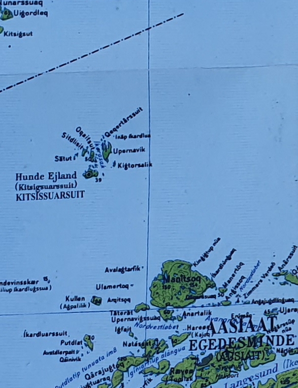
Hunde Ejland (Kitsigsuarsuit)
Actually the name Hunde Ejland is one of the many names that can be traced to the colonial time of the Dutch Whale hunters that visited Greenland a lot.
The Dutch Whale hunters in Greenland
In the 17th and 18th century, the 1st being remembered by the Dutch as their Golden Age, the Dutch Republic of Seven Provinces forged a mighty trade “empire” (strange word choice for a republic, but couldn’t find another suitable word) that spanned the globe and briefly even surpassed the English naval power.
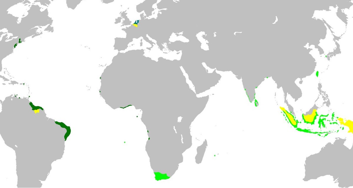
The Dutch Empire. Dark green areas were controlled by the Dutch West Indies Company; light green areas were controlled by the Dutch East India Company. In yellow the territories occupied later, during the 19th century.
It encompassed colonies and trade outposts like South Africas Cape colony (Kaapkolonie/Kaapstad/Kaap de Goede Hoop/The Flying Dutchman/Boeren/ Apartheid (shame, shame shame) dutch derived language still used in Southern Africa and even found on Geographic maps as deep into Africa as North Namibia (near Etosha) where it arrived via the South African army, when it held Namibia as a UN protectorate. Thus some of its main cities and even its capital have dutch names: Windhoek, Grootfontein. Special attention is needed for the word Koppies (Modern Dutch: Kopjes). Which pops up quite regularly in Southern Africa and which is used to describe rocks or better huge boulders that rise from the Savannah and are often used by predators to spy for prey. This word got so common in use that it travelled north and is nowadays even used in East African National Parks like the Tanzanian Serengeti or Kenya’s Masai Mara.
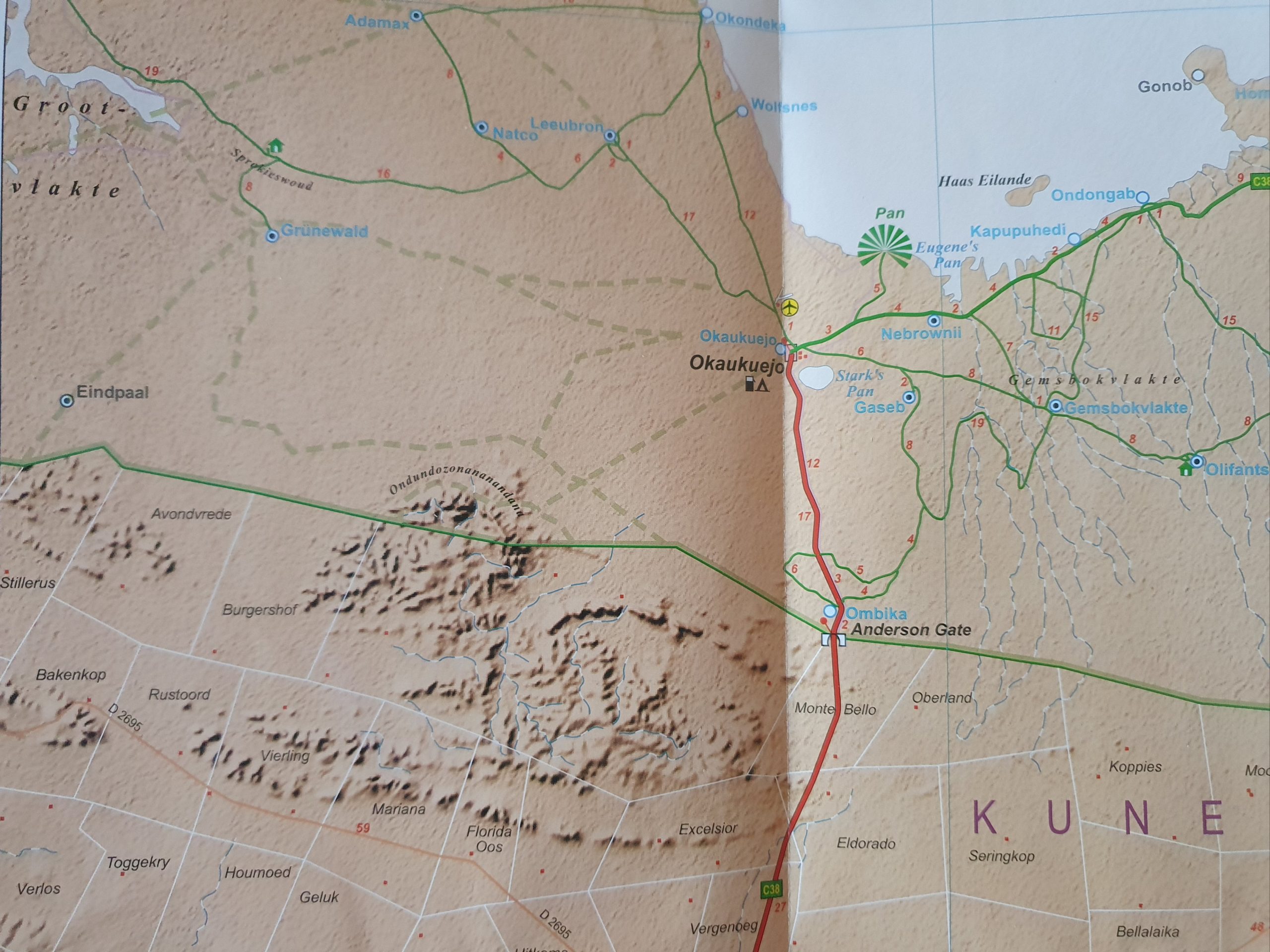
South west corner of the Etosha pan in the Etosha NP in the north of Namibia. On this map you’ll see typical dutch geographic names like (some of the names mentioned below are not on this section of the map though): Eindpaal, Avondvrede,Bakenkop, Rustoord, Grootvlakte, Brakwater, Sprokjeswoud, Burgershof, Stillerus, Verlos, Toggekry, Houmoed, Geluk, Florida Oos, Uitkoms, Mariana, Vierling, Vergenoeg, Excelsior, Eldorado, Seringkop, Koppies, Mooiplaas, Toevlug, Elandsfontein,Grensplaas, De Hoek, Hestrie Koppie, Nooitgedag, Olifantslaagte, Olifantspoort, Lynplaas, Vrede Koppies, Palmenhof, Aasvoël Koppie, Elands Drive, HartebeestdraaiTweekoppies, Gamgaas Koppie, Elandsdraai Koppies, Halali Koppie, Rietfontein, Okerfontein, Kalheuvel, Doringdraai, Twee Palms, Leeudrink, etcetera…
The dutch had trade outposts in India (coast) and they colonized Indonesia (Dutch Indies) (Jakartas old name is Batavia) and in South America they colonized Surinam (traded for Manhattan with the British) and the Dutch Antilles Islands in the Caribian. Less known is that Taiwan and Ceylon were Dutch colonies as was the coastal area of current Brazil.
The dutch formed the very 1st multinational ever named the VOC (Dutch: Vereenigde Oostindische Compagnie/English: Dutch East Indies Company). But less known is that they also formed the WIC (Dutch: West Indische Compagnie/English: West Indies Company) and the Noordse Compagnie (English: Nordic Company).
This Nordic Company dealt with 2 things:
- Trade with the countries around the Baltic Sea
- Whale hunt in the Arctic (Norse coast, Svalbard, Greenland, Canada)
The dutch government had send its whale hunters from Svalbard to the Strait of Davies and to the Greenlandic coast to hunt for whales and to trade with the local Inuit.
This was looked upon with envy by the Danish monarch who saw Greenland as a Danish colony because of the Viking history. Greenland had at 1st been a Norwegian colony, but after Norway became a part of the Danish kingdom, Greenland was maintained as a Danish colony. This explains also why there are still Norwegian language names to be found on maps.
The Danish slowly reconquered Greenland and implemented a Danish monopoly on trade and whale hunt for the whole of Greenland, thus coming into conflict with the Dutch, but also with German whale hunters.
It was not feasable though to effectively impose such a monopoly, because of the sheer size of Greenland and the Dutch kept hunting there for many years, simply ignoring the Danish.
Here are some accounts that confirm the influence that the Dutch whale hunters had on Greenlandic Inuits:
- The Dutch government of the Republic of 7 Provinces was in a war for independance with Spain and to finance this war it was eagerly searching for new opportunities to expand her economic activities and trade contacts. In 1615 the Nordic Company therefore send the cartographer Joris Carolus to the Strait of Davis to explore the coastal areas. In Holland, the Nordic Company had aquired the monopoly on whale hunt in the Arctic. Main motive for owners of ships to sail the Strait of Davis however was finding a route north of Canada towards the East and the rich spice trade opportunities. Several Dutch shipping companies gave their sailors permission to start trade with the local Inuit population in the Strait of Davis. The locals needed iron weaponry (too hunt and fish) and (iron) utensils like knives, axes, scissors, textile, multi colored beads and wooden shelves). The Dutch in return received whale products, seal meat, skins and narwhal ivory. Some Dutch sailors were not very complimenting about the Inuit. In 1624 it was written that:
vol van volck, al met pelterijen en robbevellen ghecleedt, seer begerich naer yserwerk, willende de bouten uyt het schip haelen: seer diefachtig, alles nemende dat los is, rauw vleesch en visch eetende… From: Beekman, De oude kajak van Zierikzee
This is in old dutch and translated it means something like:They wear animal skins, are very keen on acquiring everything iron, even the iron bolts of the ships, they are like thieves, stealing what they can, eating raw meat and raw fish*…
* Nowadays eating raw fish (Herring) is seen as a typical dutch delicacy ?
- Jurjen R. Leinenga, who wrote a dissertation about the arctic whale hunt in the 18th century, discovered that Dutch shipping companies played a major role as pioneers of the European whale hunt in the Strait of Davis. In the 17th century the arctic whale hunt was concentrated around Svalbard/Spitsbergen. When the number of whales caught declined, the hunt was relocated to the Strait of Davis. As of 1719 an average of amply 50 Dutch Whale hunters arrived here and there were years in which there were over 100 Dutch whale hunters in the Strait of Davis. Their main prey was the Greenlandic Whale. An easy catch and thus an economically interesting animal to hunt for. In the first half of the 18th century, the Dutch were one of the largest exporters in the world of whale products, but after 1750 the export declined drastically. In the 19th century only sporadic Dutch whale hunters visited Greenland.
- In 1999 the Dutch radio journalist Marnix Koolhaas stayed in Greenland for Dutch television broadcast organisation VPRO. He discovered that, located around a small bay, named Liefdebaai (Love Bay), which is on Disko Island, the local Inuit had a somewhat lighter coloured hair and skin than their peers elsewhere. They told him that they thought that they were descending from Dutch whale hunters that visited Disko Island in the 17th and 18th century for pleasure, leisure, partying and amorous activity. The stories these local Inuits tell are about the Dutch sailors, seducing the local women and leaving them pregnant. According to Koolhaas there are several indications that show that the dutch culture is still impregnated into that of the local Inuit. E.g.:The local music very much sounds like the traditional dutch music played for wooden shoe dances (but you need to imagine the clicking of those wooden shoes yourself) and including their accordeons that sound quite identical as when they are played on the local farmer market in Marken (a famous traditional dutch village). The local villages and bays bare dutch names and the traditional costumes include the many multi colored beads that the dutch use in their traditional costumes.
Conclusion: Most dutch names from the 17th and 18th century have dissapeared, but the names that got incorporated into Danish survived.
There’s much more to tell about this very interesting period in Greenland and not exclusively about the Dutch but also about the Danish, Germans, Norwegians and even the French. And about the Inuit too. Maybe someone else will pick up on that story trail, but for now I’m going to get on with the travel part of my blog story?
The last stretch of that rough boatride
After leaving the relative tranquility of the Hunde Ejland archipelago where the waves and wind broke upon the shores of the islands, we were now crossing the last section of open water before reaching the large archipelago at the southernmost part of the Disko Bay.
Then we reached the archipelago and the waves got less rough.
On one of the larger islands was the colony of Egedesminde or Aasiaat…
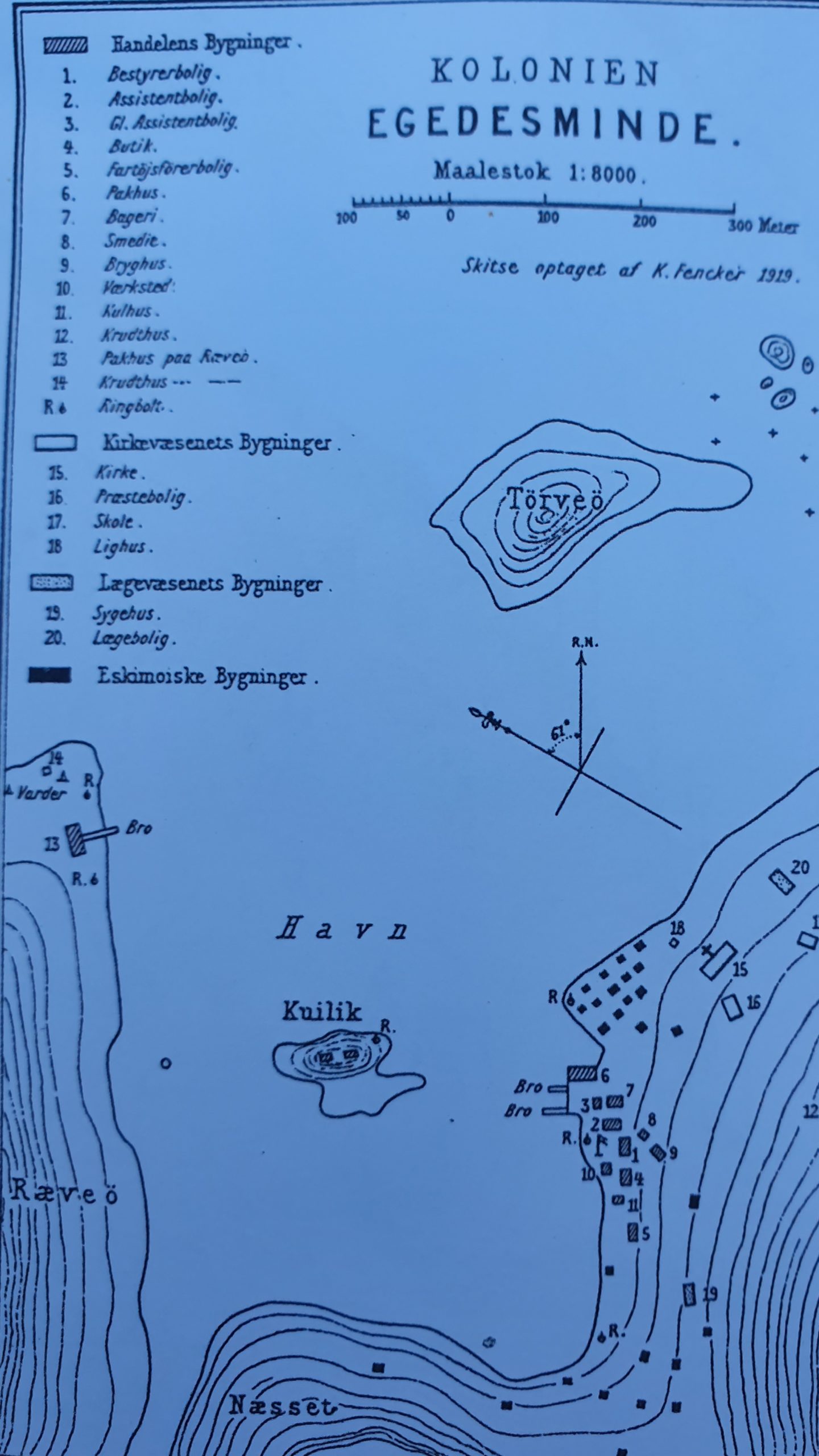
The colony of Egedesminde/Aasiaat
Aasiaat or Ausiait, formerly Egedesminde, is a town in the Qeqertalik municipality in western Greenland, located in the heart of Aasiaat Archipelago at the southern end of Disko Bay. With a population of 3,069 as of 2020, it is Greenland’s fourth-largest town.
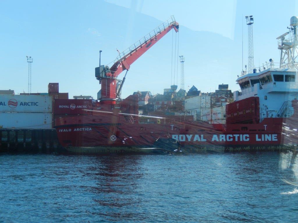
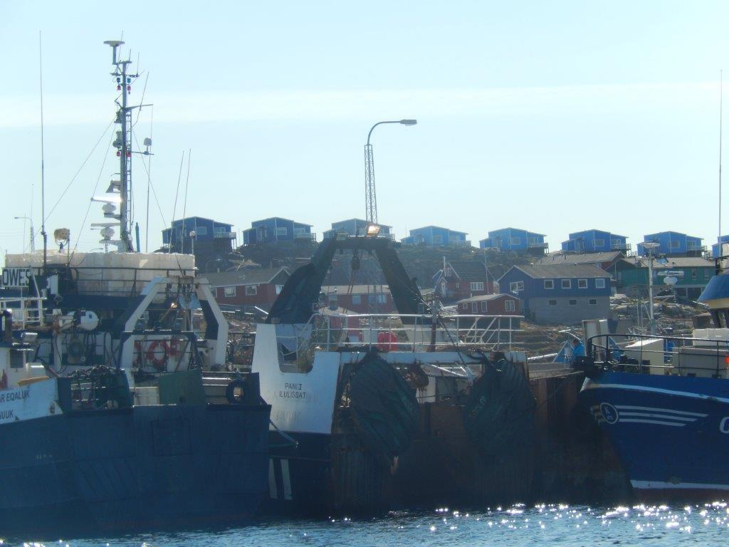
The ferry entered into the harbor…
There we stepped off board and threw our luggage onto a waiting truck which would transport it towards the Sjomanshjemmet hotel. But The Wandelgek didn’t stay, but immediately boarded another ship because he was going on another whale hunt (read more about that in my next upcoming Greenland weblog).

