Kungsleden / Kings trail
In the summer of 1993, “The Wandelgek” walked among the reindeer on the Kungsleden trail.
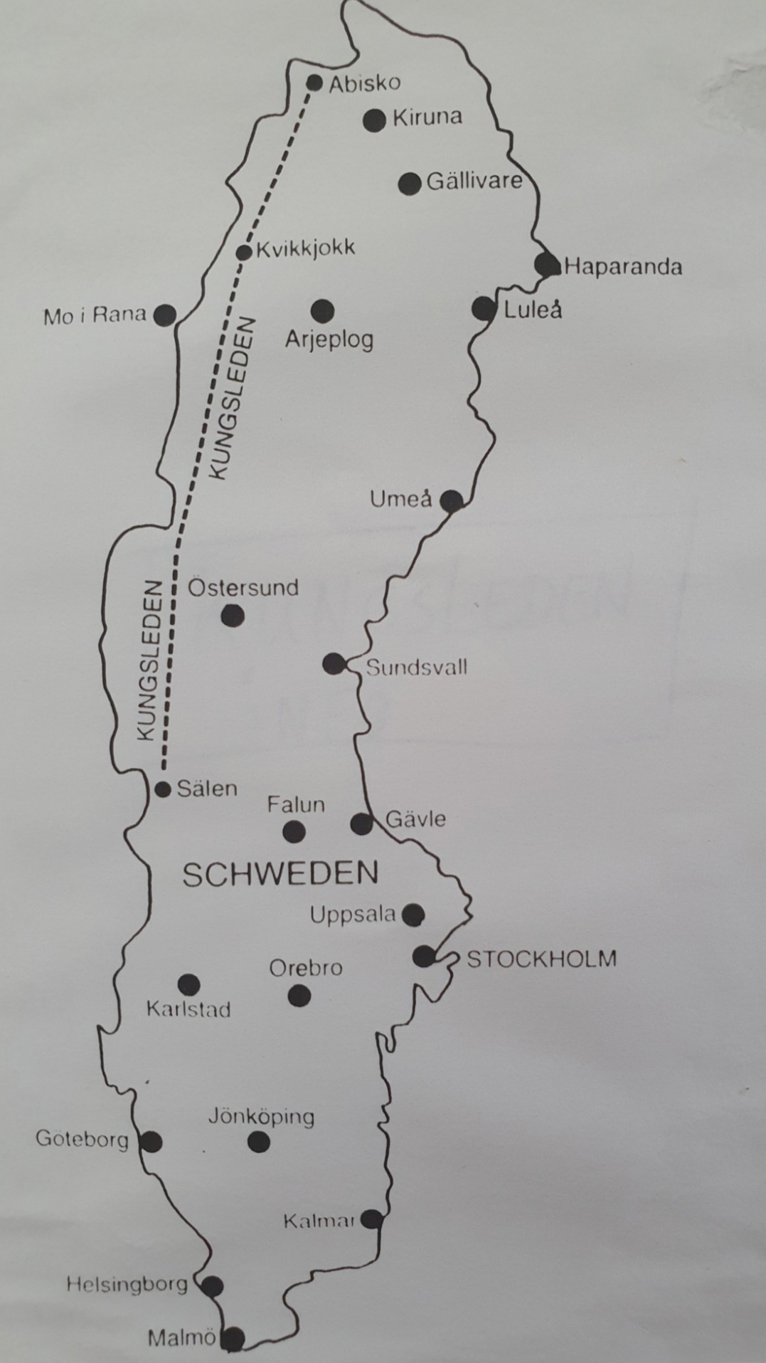
The ‘Kings trail’ – Kungsleden – is the most famous long distance hiking trail in Sweden. The official route of about 450 km runs from Hemavan (near Tärnaby) in south-west Lapland to Abisko in northern Lapland. There is also a piece of Kungsleden more south in Sweden, namely in the fjäll region around Sälen, Fulufjället Grövelsjön. But the real Kungsleden, as he is internationally known, runs from Hemavan to Abisko. At regular distances (depending on the route) there are fjällstations, huts to stay the night, huts that sell provisions, … There are routes where you have to cross lakes with boats (whether manual or motorized).
Transportation
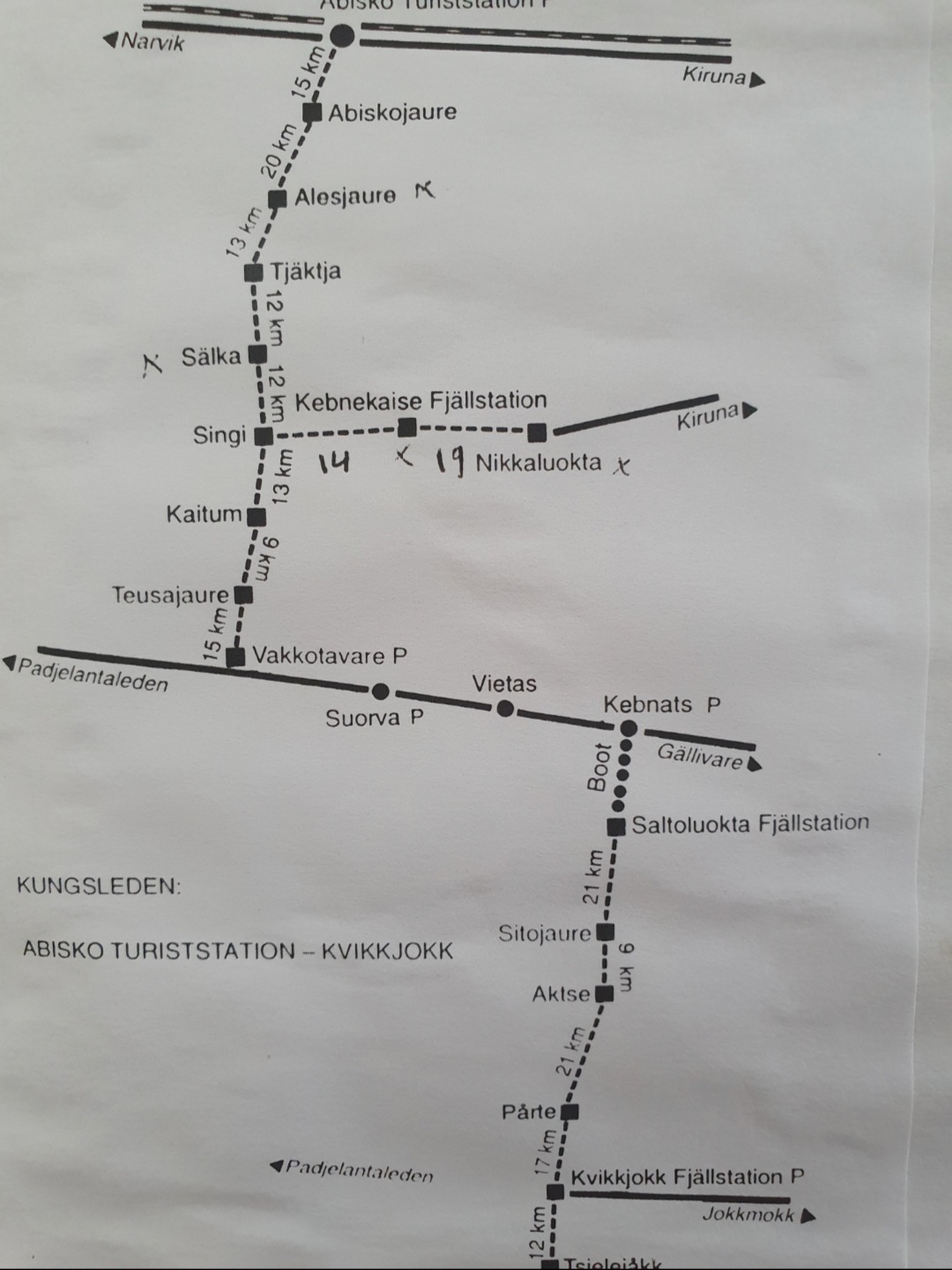
The Wandelgek has covered the 105 km long route from the Abisko Turist Station to the Sami village of Nikkaluokta, where the journey from the Turist Station to the Singi huts is counted to the Kungsleden (72 km). In addition there is a route from the Singi huts via the Kebnekaise Fjällstation to the Sami village Nikkaluokta of 33km. The route, consisting of 7 daily stages, was completed in 6 days carrying backpacks of 19+ kilos (which was quite usual to do in those non light weight gear years).
Daily passenger electric trains run by SJ AB connect Stockholm with the Norwegian city of Narvik, stopping at both the Abisko village (the name of that railway station is Abisko Östra [east]) and the Abisko Turiststation. Additional regional trains provide links within the Kiruna-Narvik stretch. Abisko is also reachable by car via the highway E10 which links Kiruna and Narvik since early 1980s. Other forms of local transportation include hiking and dog-sledding in winter. A chair-lift provides access to the summit of nearby Mt. Nuolja.
The Wandelgek actually did visit Kiruna as well as Narvik by train. Specially the railway to Narvik is quite something because it skirts along the walls of a very narrow Norwegian fjord, before arriving in the town.
There is a busconnection from Narvik to Fauske (on the railway from Bodrog to Oslo).
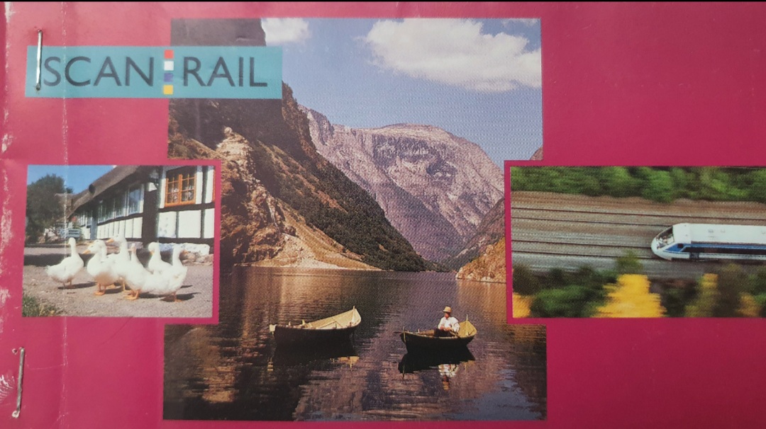
In Scandinavia it might be worthwhile to buy a Eurail pass (if your a non European citizen) or an Interrail pass (if your a European citizen). It enables travel by train through Denmark, Norway, Sweden and Finland. These replace the previous Scanrail pass, which enabled you to travel by bus, train and ferry through Denmark, Norway, Sweden and Finland.
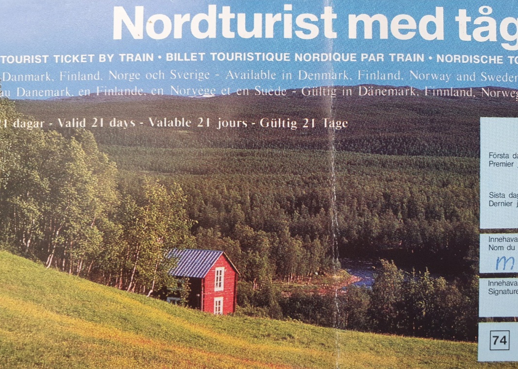
The Wandelgek did not use the Interrail pass in 1993, but its pre-predecessor, the Nordturist med tag, which was later replaced by the Scanrail pass which he used in 1997, travelling through Scandinavia. The Interrail or Eurrail passes (depending on what passport(s) you own) are probably the next best thing whenever you travel with public transport instead of an airplane or a car. Far less polluting and more sustainable too 🙂
More information about rail passes at: Scandinavian Rail
Required Training
Do you need walking/survival training to finish this hike? Bollocks! Although you do need a quite good walking condition and you need to have your wits about ya, meaning you need to use common sense when walking, it can be done (provided you’re in a good physical condition), without any previous training. Read some books and blogs about fjäll walking and what to pack and you have enough knowledge to finish this walk.
…and what about winter?
In winter I do advice extra walking/survival training. Everything is white, covered in think layers of snow. Rivers too! Navigation can not depend on the orange painted rocks on top of collected stones. They are covered in by snow too. Alternatively there are the high poles carrying red crosses that are meant for snow scooters. Training would be needed for walking on snow shoes, maybe langlaufen and some basic survival techniques in snow. Navigation is important too.
Actually you cannot see the trail anymore and you need to walk navigating on geographical features of yhe landscape. Again map and compass are important because batteries can run empty and a connection can get lost.
Solo hiking?
I do not advise to walk this one alone though. Hike together. The hike is following a trail, not a clear road or a path. This means that walkers do not follow the trail very precisely but sometimes walk higher through the vales and sometimes lower near the main river, depending on how much rain falls. An accident can easily happen and although there is a regular stream of walkers following the trail, they can easily miss you. It is much safer to have someone with you or walk in a group. Remember: These are mountains in the arctic and weather can change quickly.
Packing list
What to bring on an arctic trail walk:
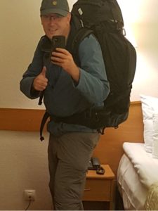
- A large 75 to 80 liter backpack
- A warm sleepingbag (contains dow)
- A preferably silk sheet sleeping bag
- A self inflatable matras
- Layers of clothing (t-shirts, fleece and sturdy trousers (g1000))
- A gas burner
- A gas container
- A light weight tent
- A light weight hammer and herrings to fasten/install your tent
- Good walking (mountain) shoes
- Boots or waterproof canoe/kayak shoes
- A walking rain poncho
- Several nutritious freeze dried meal or noodles/instant soup/instant coffee
- A water container/thermos (personally I recommed the one by Stanley (yes the Stanley form the famous Stanley knife))
- A spork, a cup, a plate, cooking gear set
- A Swiss pocket knife
- A universal world electricity network plug (e.g. a Skross worldplug which includes usb ports as well)
- A hands free head flash light
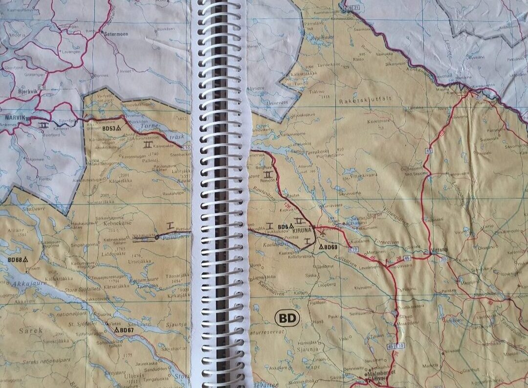
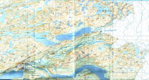
- Detailed maps (e.g.:like this one):
- Compass
- Mobile phone
- A mosquito net to wear over a hat or cap
- A hat or a cap
- Sunglasses (the trail crosses snowfields, sunglasses protect the eyes against the bright white reflections)
- Light weight food (nut and fruit bars e.g.) and several nutritious freeze dried meals (food can be obtained in the huts, but it is not cheap)
- A travel medical kit
- Personal hygiene and care products
- Biodegradable Washing detergent for cold temperatures
- Towels (lightweight and small)
- Plastic garbage bags to take your garbage with you
- A good physical condition!
Nice to have’s:
- Binoculars
- Water proof cannisters for Coffee/tea/sugar/etcetera.
- Walking poles( I didn’t use them when walking the trail in 1993, but I got a bit older and I can imagine using them now, like I did recently on the Great Baikal Trail)
STF Huts and official Campsites
Huys and official campsites are maintained by the STF, (the Swedish Tourist Association) and through them you can reserve a room bunkbed or a space to camp, but remeber that you are allowed to camp everywhere in the fjäll are (except in the Abisko NP). Therefore The Wandelgek did not use any of the facilities except the shops and the weather reports provided at the shops.
The Swedes have introduced the Allemansrätt (Everyman’s Right), to make it possible to camp free in virtually all of Lapland, but this right comes with duties too. It only works when.you clean up your mess. Be carefull with open fire and take with you what you brought into nature. Do not leave any garbage at all!
There are STF cabins and campsites at Abiskojaure, Alesjaure, Tjäktja, Sälka and Singi and a Turiststation at Abisko Ost, a fjällstatiin at the Kebnekaise and a campsite at Nikkaluokta.
More info on reserving a hut: Swedish Tourist Association
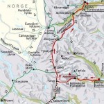
The trail route
[imagemap map=”imgmap_css_container_imgmap201252225156″ direct=1 id=”imgmap201252225156″ img=”http://www.wandelgek.nl/wp-content/uploads/2012/05/kungsleden_kaart.png?1335993155861″]
[area shape=circle alt=”Abisko and surroundings” title=”Abisko and surroundings” url=”http://www.wandelgek.nl/?p=3871″]400,115,13[/area]
[area shape=poly alt=”Stage 1: Abisko Turiststation – Abiskojaure 15km – ” title=”Stage 1: Abisko Turiststation – Abiskojaure 15km – ” url=”http://www.wandelgek.nl?p=3840″]383,124,349,150,336,160,351,173,390,149,391,126,395,128[/area]
[area shape=poly alt=”Stage 2: Abiskojaure – Alesjaure 20km” title=”Stage 2: Abiskojaure – Alesjaure 20km” url=”http://www.wandelgek.nl?p=3842″]329,162,332,208,293,238,282,268,262,277,284,291,311,249,348,218,358,192,340,168,340,168[/area]
[area shape=poly alt=”Stage 3: Alesjaure – Tjäktja 13km” title=”Stage 3: Alesjaure – Tjäktja 13km” url=”http://www.wandelgek.nl?p=3844″]265,281,284,291,253,329,255,345,231,333,251,294,263,280,263,280[/area]
[area shape=poly alt=”Stage 4: Tjäktja – Sälka 12 km” title=”Stage 4: Tjäktja – Sälka 12 km” url=”http://www.wandelgek.nl?p=3846″]229,337,245,416,268,411,245,342,246,342[/area]
[area shape=poly alt=”Stage 5 + 6: Sälka – Tingri – Kebnekaise Fjällstation 12 + 14km ” title=”Stage 5 + 6: Sälka – Tingri – Kebnekaise Fjällstation 12 + 14km ” url=”http://www.wandelgek.nl?p=3848″]247,417,255,447,253,484,317,496,351,469,353,452,313,468,307,479,269,479,269,464,273,445,261,411,261,411[/area]
[area shape=poly alt=”Stage 7: Kebnekaise Fjällstation – Nikkaluokta 19km” title=”Stage 7: Kebnekaise Fjällstation – Nikkaluokta 19km” url=”http://www.wandelgek.nl?p=3852″]356,453,349,468,378,482,399,476,424,481,438,484,463,471,456,458,430,468,391,461,374,468,359,449,359,449[/area]
[/imagemap]
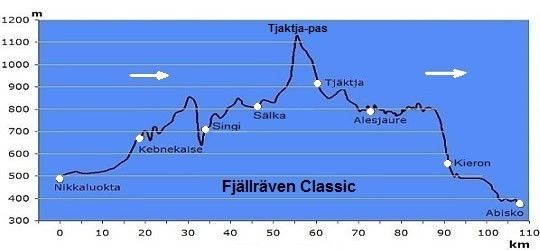
The diagram below shows in reverse order the course of altitude during the traveled trek. The highest point of the trip was the 1100m high Tjäktja pass. During the trip the Wandelgek was provided with a backpack with about 19 to 20 kilos of ballast.
Prior to the walking tour of the Kungsleden, “De Wandelgek” gathered provisions in Abisko and at the Turiststation. Nearby was also a beautiful, 20 meter deep gorge (the Abisko canyon) worn out by the Abisko River, which then flows into Lake Torneträsk.
The following stages have been taken:
Stage 1 : Abisko Turiststation – Abiskojaure 15 km (through the Abisko National Park)
Stage 2 : Abiskojaure – Alesjaure 20km
Stage 3 : Alesjaure – Tjäktja 13km
Stage 4 : Tjäktja – Sälka 12km
Stage 5 + 6 : Sälka – Singi 12km; Singi – Kebnekaise Fjällstation 14km
Stage 7 : Kebnekaise Fjällstation – Nikkaluokta 19km.

